We start our trip from Chitral Valley and finish it in Gilgit, the administrative capital of northern areas of Pakistan. In this trip, we walk beside the famous historical Wakhan corridor & crossing Shahjinal Pass, Brogol Pass, Koarmabar Passe and Chilinji Pass.
Airport Ave, Islamabad Gandhara International Airport, Islamabad, Attock, Punjab, Pakistan (Google Map)https://goo.gl/maps/wGTa85SbADUg7FGM8
3 Hours Before Flight Time
Arrive Islamabad, transfer to the hotel. Today visit the Ministry of Tourism to get the trekking permit. Rest of the day is free or explore the twin cities of Rawalpindi and Islamabad. Overnight in the Hotel.
After breakfast, passing through the lush green plains of Peshawar, we ascend the Malakand Pass that brings us to the Swat valley. We drive shortly through the Swat valley to arrive at Dir for lunch.
Breakfast at hotel, proceed for the fabled valley of Chitral by road.
From Dir, we leave the asphalt road and drive on jeep track to ascend of Lowari Pass (3,200 Meters), the gateway of Chitral Valley. From the top of the pass, we have a fascinating view of the Hindukush mountains stretched towards North in front of us, and Himalayan mountains in the south. The descent of the pass is more interesting than the ascent, as we take 96 hair-pin turns to get to the valley floor. Passing through the dry and rocky landscape we arrive at Chitral town. Overnight Motel.
Two hours jeep drive from Chitral to Buni. Buni is the largest town in upper Chitral, and quiet historic place because of siege
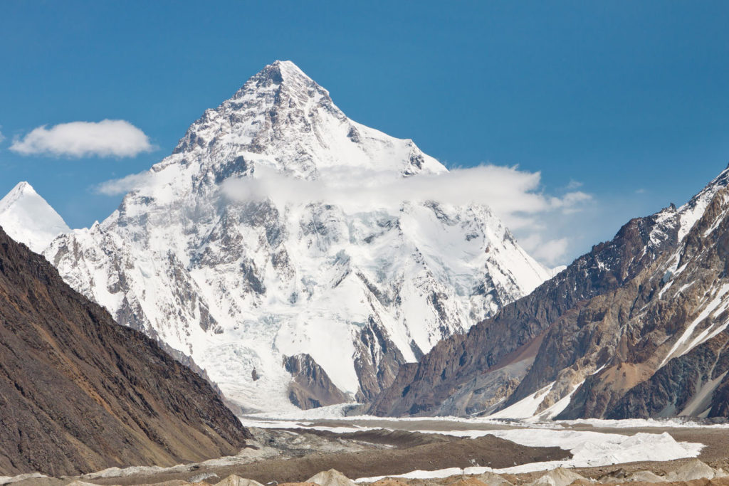
of Chitral in 1895. Buni town is on the south of Mastuj river. Othal is a bit further settlement after Buni if the road remains open then the jeeps go up to Othal. We will start walking from Othal a zigzag path leads to Zani Pass. Views from the top of Zani Pass are outstanding. Top of Zani Pass is wide flat ground with outstanding views of Trich Mir (7708meters) the highest peak of Hindukush range and also the Trich valley on our west. In the north, the pass offers views of Wakhan corridor and Afghan border. On our east will be the area of Shah Jinali and Broghil Passes and in South will be the main Chitral town. After some photography on the top, we will descend down on the Trich valley side of the Pass and walk towards Zundragram our first camping site. Overnight at camps
Today we will continue our trek in Trich valley the trek today is easier than yesterday. We will walk along the Rich River, half of the distance will be covered by jeeps today. Arrive Sor Rich for overnight camping.
This is a beautiful walk through knee-high grass and flowers and across plenty of side streams surrounded by groves of willows, with the Shah Jinali river well below you on your left. After three hours the path turns north and here we will leave the mainstream and climb up a green hillside. Arrive Jinali Ghari a summer shepherds settlement.
Today in the start the trek is again through the knee-high geraniums and wild onions, with good views north to the snowy dome of Qalaeast (6315meters) and a mountain wall separating you from Afghanistan and the Oxus river. Just before the top is a wide flat meadow which is known as the “Kings Polo Ground” that gives the pass its name Shah Jinali. We will cross the meadow and arrive at the top of the Pass. The top is also flat, with several small lakes on either side. We will walk down to Yashkist for overnight camping.
On the trek, we would encounter many river crossings, so it is wise to keep sneakers in your day pack. For the first 3 hours, we walk under the shade of poplar and willow trees along the bank of Yarkhun river, crossing three branches of Kankhun river (no bridges). Excellent views of Thui peaks with their respective glaciers: Thui II (6,525m) with Shetor glacier, Thui I (6665m) in the middle of Panarello glacier & Kotalkash glacier and Kouo Zom (6875m). We camp at (3325m) on a green spot facing the Kouyo Zom mountain in the south, Broghil region begins from here and local people have Mongolian features, having migrated from Wakhan.
Today we are in the area called Boroghil that offers the easiest route between Indian sub-continent and Central Asia, frequently featuring in the history. The population speaks Wakhi language, also spoken in southern Tajikistan, eastern Sinkinang and upper Hunza (Pakistan). We ascend around a thousand feet from the river to a vantage point with excellent views of Chhatibol glacier with its numerous crevasses. Ishkarwaz houses Chitral Scouts and border police`s post to guard the entrance to Wakhan Corridor through Boroghil Pass. Wakhan Corridor is 15 km wide belt of Afghanistan separating Pak. and Tajikistan. While finalizing the boundaries between Afghanistan and British India, this belt was purposely planned as the buffer zone between British India and the Russian Empire. Broghil Pass was used to be the shortest and easiest route from Central Asia to the Indian Subcontinent. These days it not allowed to cross Broghil Pass we will only go to the top of the pass and walk back by the same route to Ishkarwarz for overnight camping. On our way to the Broghil Pass, we will leave our packs in Ishkarwarz our tonight’s camping site and carry only water and cameras with us.
A couple of hours walk away from Ishkarwaz is Garhil. Inhabited by a few households, Garhil is one of the most beautiful spots of the whole area in terms of landscape. After crossing Garhil, one walks beneath the Darwaza Pass and reaches Lashkargaz (or Lashkargah Goz). Darwaza pass is another way to enter into Agfhanistan’s wakhan area. Before Lashkargaz, the main attraction of this day is a series of small but beautiful lakes with changing colours. In total, these are five different lakes just adjacent to each other. Every few kilometres on this path, one comes across a new pasture which is used as the grazing land for yaks. Lashkargaz is the place where traditional polo festival is held each year where wakhi people from the whole region participate.
It is a very gentle walk up to Karomber that climbs very smoothly. One passes through small settlements of Rabat and Lale Rabat before reaching the Karomber Pass at 4200 meters. Karomber Lake is further half an hour away from the pass at 4160 meters. There are some camping sites maintained along the lake. Porters normally stay in open sky small huts built above the lake. They must be provided with a waterproof sheet as a protection against snow and rain.
This is the easiest day of the whole trek with a very gentle walk of a few hours. One enters into the Karomber valley after crossing Karomber lake which does not enjoy the greenery and beautiful landscape of that of Broghil valley. Swinj is inhabited by the Gujjar people. They come from Imit during summer months with their livestock. They are not as friendly as the wakhi people and must be treated with caution.
This is one of the longest days of the trek included with it is the crossing of Chittiboi glacier. Glacier crossing takes around 2 – 2.5 hours. The crossing itself is not very technical however donkeys with load struggle on it. At Sokhtarabad, a campsite is maintained along with the police post where one must register. The post comes under the jurisdiction of Ishkoman police station.
You will cross a pully bridge. Arrive Chillinji gah (forest area is known by local people “Warguth jungle”).
Today the whole trek is uphill, so we will take an early start. From Chilinji we will turn toward the east for Chilinji Pass and on our west, the trek is going to Chitral valley. First, we will arrive at the base camp of Pass after some rest at the base camp we will continue for the high camp. After base camp, the trek is quite steep up to the high camp so be prepared for a tough walk. Arrive at the high camp for overnight. The place is sort of a small rocky ground with Chilinji Pass in the front. (7/8 hours uphill walk).
From the high camp, the pass is about 250 meters high. Which takes about 3 hours to climb up. Once we reach the top of Chilinji Pass then its all descend down to the Baltar. First, we will cross a small snowfield after snowfield the trek is along the Chilinji glacier. When the glacier finishes then the trek comes to its normal. Arrive Baltar a green place parallel to the Wakhan corridor and Chilinji river, with many stone houses made by the shepherds. Overnight camping at Baultar. (7/8 hours walk)
We will again start walking along Chilinji river. Now as we are in Chapurson valley so you can feel the difference between Ishkoman and Chapursan valleys. The Chapurson valley is quiet soft than the Ishkoman valley. Cross the red mountains which are on the boundary of Hindukush range and Karakoram range starts from here. Arrive Ziarat Baba Ghundi, a holy place for the locals as here is the shrine of famous Muslim saint BabaGhundi Shah. After some rest and lunch here we will board on jeeps once again and start to drive toward Sost. After a short stay in Sost the last Pakistani city before China we will continue our drive on Karakoram highway to Passu. Arrive Passu in upper Hunza. Passu is a small charming village in the backdrop of soaring Passu Cones, with Passu and Batura glaciers at short walking distance. Walk through the village to see the village life. Overnight at Lodge. (5/6 hours walk – 4/5 hour drive)
Morning drive from Karimabad. En route short stay at Rakaposhi (7,788m)
viewpoint. Continue to drive to Gilgit. Arrive at Gilgit for lunch and some sightseeing. Visit Kargah the rock-carved Buddha from 7th century AD. In ancient times, the Kargah valley used to be the travelling route of the Buddhist monks, to go to Taxila. Stroll down the colourful Bazaars of Gilgit. On our way, we see the old Silk Route used by the Buddhist monks and traders. After this stay at Gilgit, we will continue to drive to Chilas on the bank of Indus river, overnight at hotel. (260 km, 6/7 hours drive.)
Full day drive on Karakoram Highway to Islamabad. We start early in the morning, to cover the 12 hours long drive. A short stay in Besham for lunch, by evening we shall reach Islamabad. Transfer to hotel for overnight. ( 11/12 hours, 500 km)
Transfer to airport for the flight to home destination.